/ ENGINEERING SERVICES
Operational Visibility and Control
We bring radical transparency to complex industrial ecosystems. Our end-to-end plant digitization gives you absolute control over every asset, process, and shift.
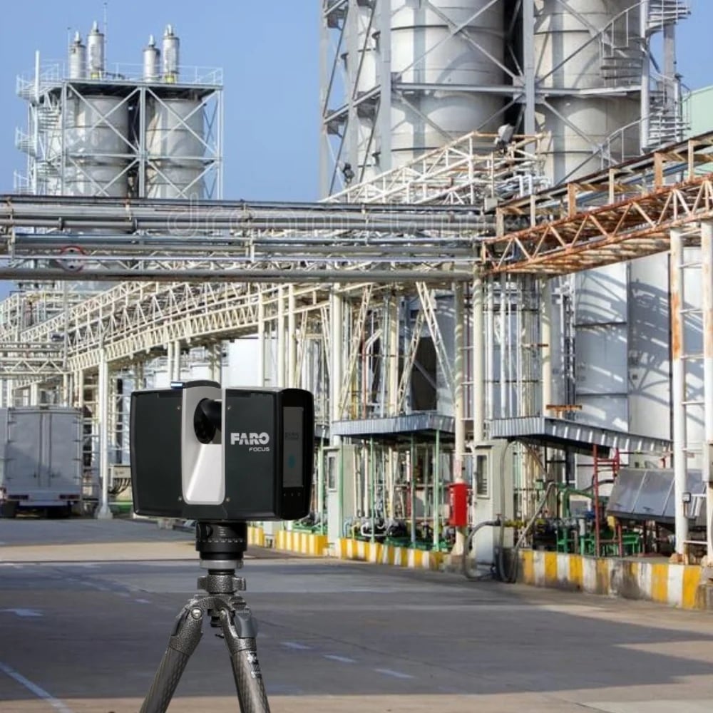
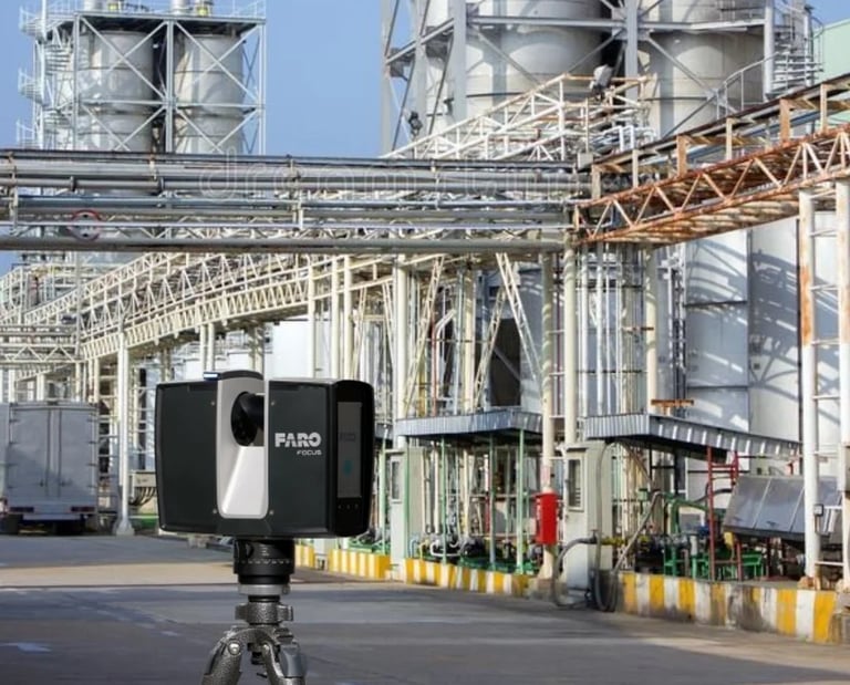
Industrial Plant & Factory Digitization
Using terrestrial LiDAR, we capture your facility's exact geometry and generate a millimetric-accurate 3D digital twin. This render integrates with your industrial software, allowing for seamless remote simulation and spatial coordination.
Digital Twin
We generate precise point clouds and 360° walkthroughs for complete reality capture. This digital twin enables remote inspections, team collaboration, and asset lifecycle management.
/ ENGINEERING SERVICES
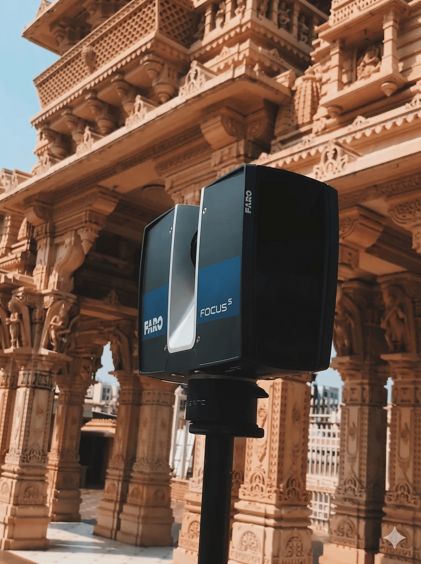
Spatial Intelligence & Preservation
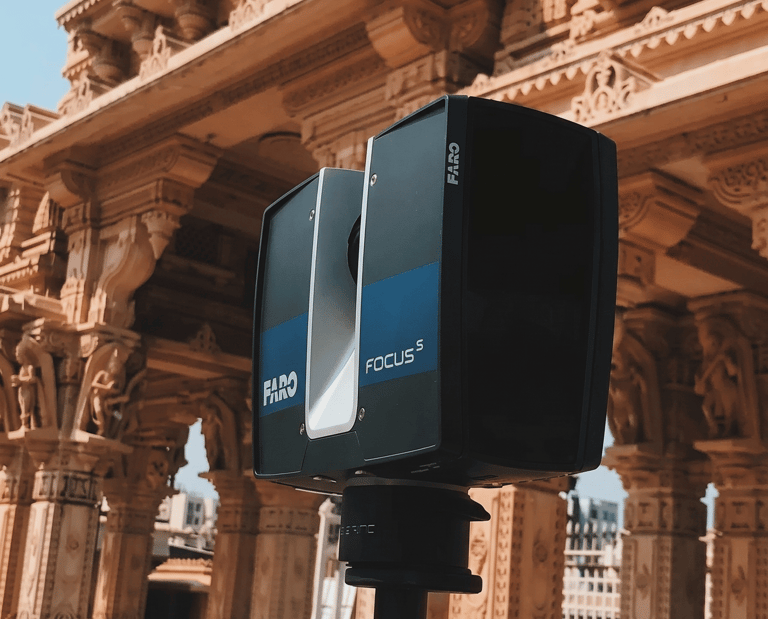
We capture exact architectural and historic geometries to generate millimetric-accurate 3D models. This spatial data ensures precise documentation for archival preservation and efficient asset management.
Utilizing terrestrial LiDAR, we capture the exact structural geometry of historic assets to generate millimetric-accurate digital twins for archival preservation and virtual restoration.
Heritage & Architectural Preservation
BIM & Building Documentation
We deliver Scan-to-BIM services and as-built floor plans across residential, commercial, and industrial facilities to optimise renovation projects and asset management.
/ ENGINEERING SERVICES
Calibrated Precision
We bridge the gap between physical components and digital manufacturing. Our workflows guarantee sub-millimeter accuracy for critical industrial assemblies.
Reverse Engineering
Complete physical-to-digital translation. We reconstruct fully parametric CAD models from raw point clouds, respecting original geometric dimensioning and tolerancing to ensure manufacturing-ready design intent.
Deviation Analysis
Nominal vs. actual inspection reports. We compare physical parts against original CAD files to identify wear patterns, deformation, and manufacturing defects, delivering precise deviation heatmaps for critical quality control.
/ ENGINEERING SERVICES
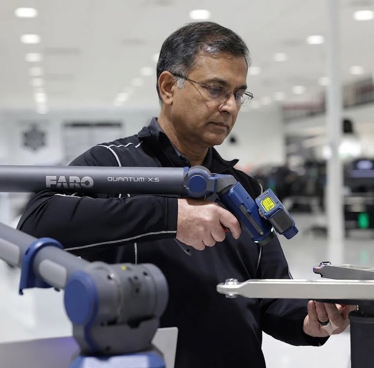
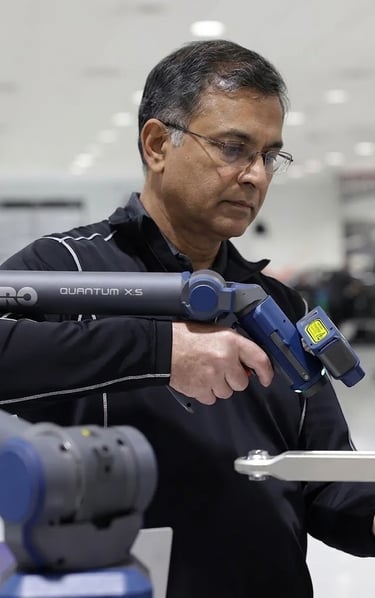
Micron-Level Dimensional Inspection
We leverage advanced coordinate measuring machines to deliver micron-level dimensional verification. Our precise metrology services ensure strict adherence to GD&T standards and rigorous quality control.
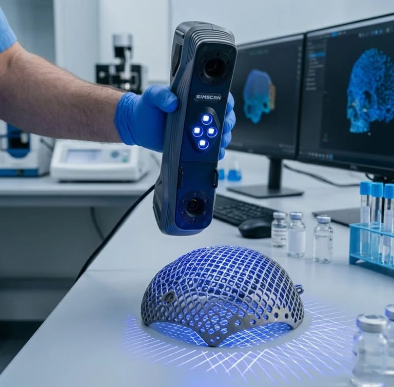
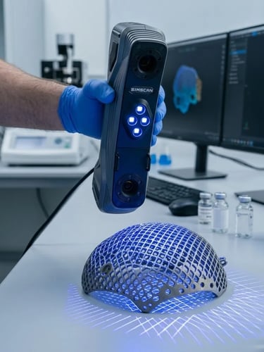
CMM Inspection
Our 3D scanning services enable fast and precise inspection of components, assemblies, and tools. Using advanced hand-held scanners, we delivers high-performance 3D scanning services for industrial inspection requirements.
Scan to CAD Services
Conversion of point cloud data into precise 2D CAD drawings and 3D models. Our design engineers create detailed, dimensionally accurate drawings suitable for engineering analysis, fabrication, and construction documentation.
/ ENGINEERING SERVICES
High-Resolution Aerial Mapping
High-resolution drone surveys and aerial mapping delivering precise, site-wide reality capture and as-built data for seamless spatial coordination.
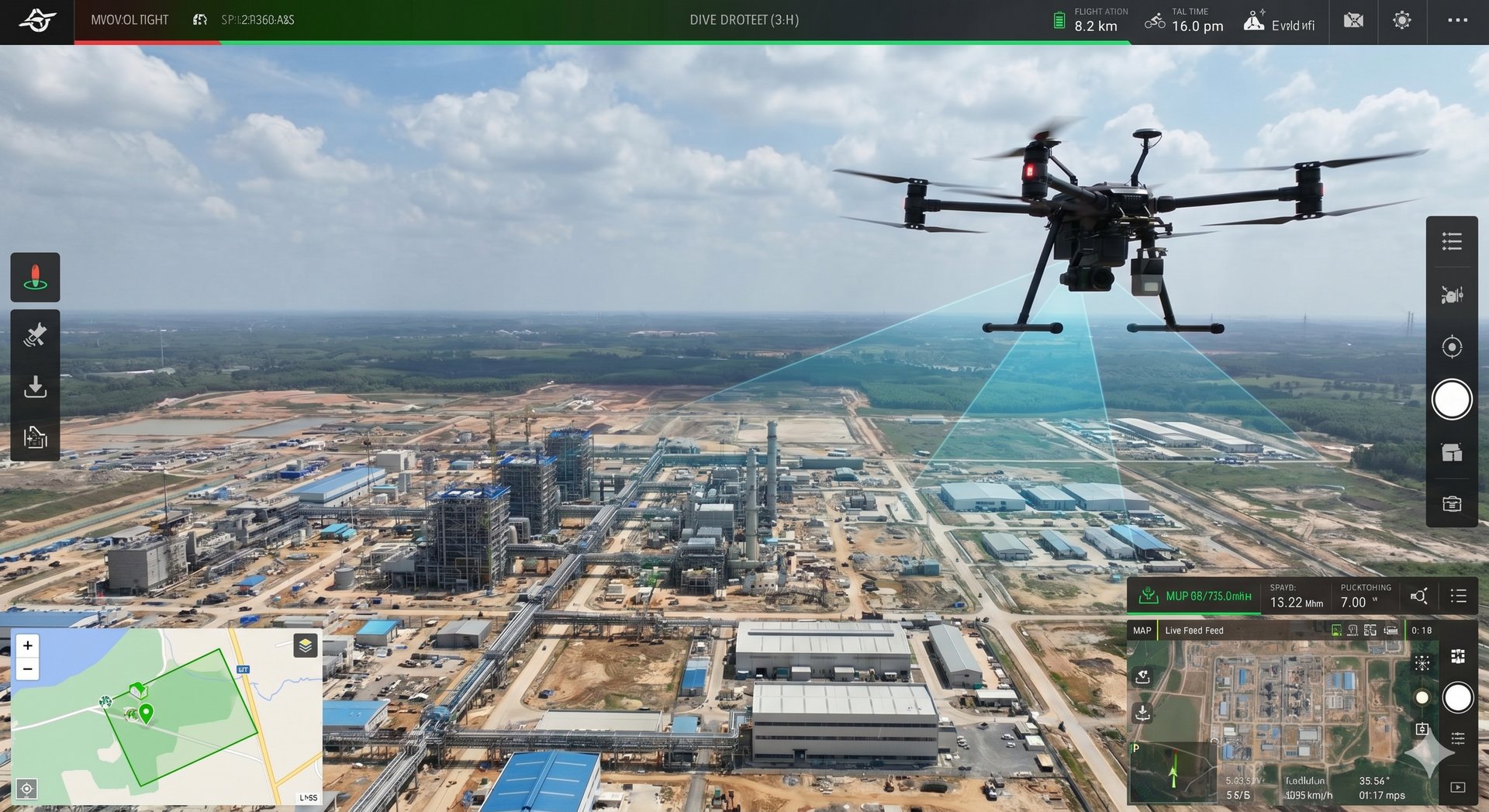
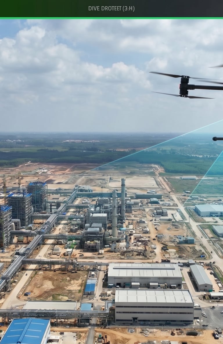
Drone Survey Services
Our UAV-based survey services use drone photogrammetry and LiDAR to capture large outdoor areas rapidly — delivering orthophoto maps, digital elevation models, topographical surveys, and volume calculations.
As-built documentation service
We produce accurate 2D as-built drawings, floor plans, elevations, and sections directly from 3D scan data — replacing outdated, inaccurate paper drawings with verified, dimensionally correct documentation.
Request Technical Consultation
Connect directly with our engineering team to review your tolerances, scanning requirements, and parametric CAD deliverables.